Tuesday, 17 April 2012

Easter in Wellington 6-9 April

Hotel
We're booked into the James Cook Grand Chancellor hotel which is spacious and comfortable (once we’d sorted out the air con). It’s also central and we can walk to most places from here. We don’t really want to breakfast in the hotel and that’s a bit of a problem because lots of places seem to be closed for Easter. We have the most amazing weather all w/e, with clear blue skies, bright sun and very little wind.
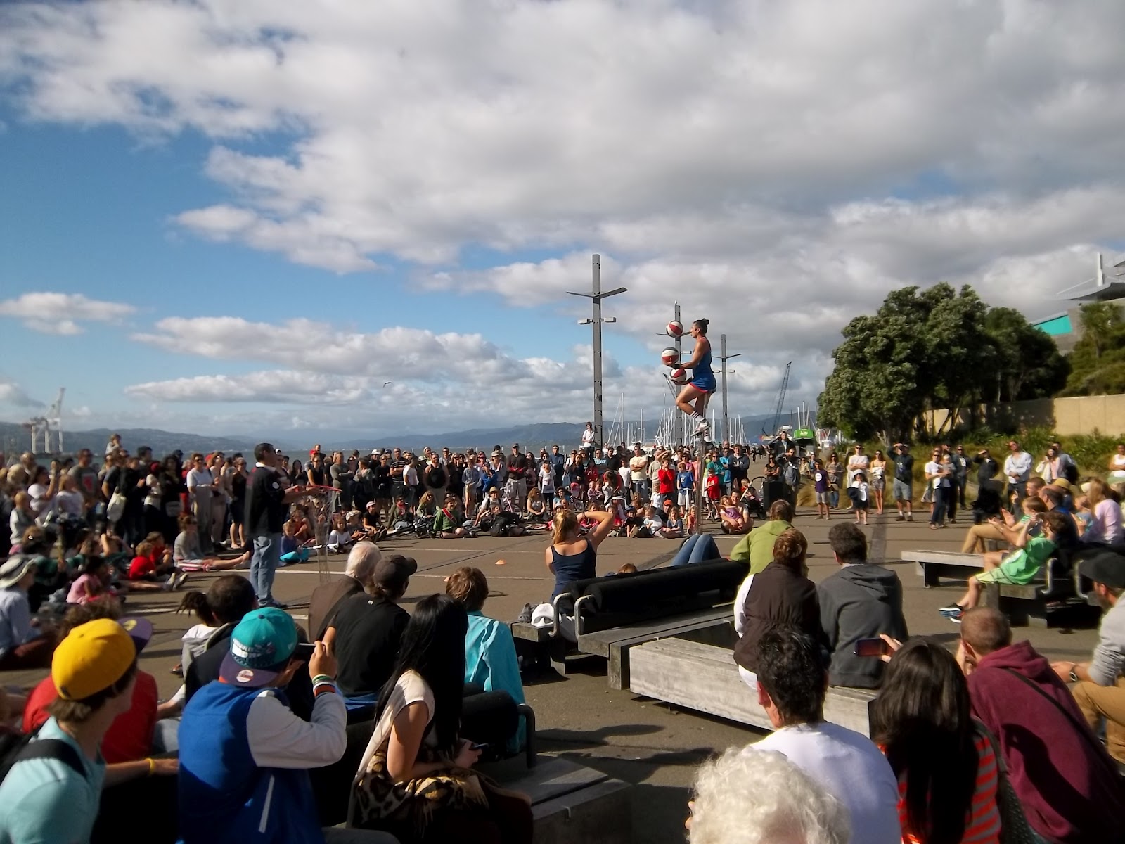
Street performer drawing the crowds in the courtyard outside Te Papa

Te Papa Museum
It’s certainly impressive and requires more than one visit. A busy place, it’s free entry to encourage visitors, but the building creates a feeling of height and space so it doesn’t feel crowded. We ‘did’ the ground floor which covers mostly natural history (including the giant squid), geology (where the earthquake simulation wasn’t as good as Auckland Museum’s ), and the Waitangi Treaty. We went on up to the national art collection on the top floor for our second visit. It’s a big collection but again, as with the Auckland gallery, you get the feeling it’s playing second fiddle to the galleries of Europe, just so much newer with less inherited wealth of paintings. Their collection of NZ artists is interesting and the narrative works hard to explain the particular difficulty they’ve encountered. Artists historically felt forced to leave their native NZ to study and develop alongside European artists but as a direct consequence, back home, their art was considered too avant garde by NZ’s more conservative audience, so they often remained abroad. Nowadays the dilemma is that their art is assiduously bought up by NZ galleries which takes it out of the European scene with the result that its importance internationally is all too easily be overlooked by art historians.

Te Papa: looking down to the ground floor from the top gallery

I was pleased to see the Katherine Mansfield portrait  (Anne Estelle Rice) and also found a lovely landscape by an NZ artist called Rhona Haszard who had spent some time living in the Channel Islands.

Botanical Gardens
We took the cable car up high above the city and walked through the gardens back down into town. There are big areas devoted to cactus etc which are lovely but we were quite late in the day so didn’t get to do it justice really. The tea house and Rose Gardens were a bit of a disappointment but that was largely due to the most awful tea served at the cafe.

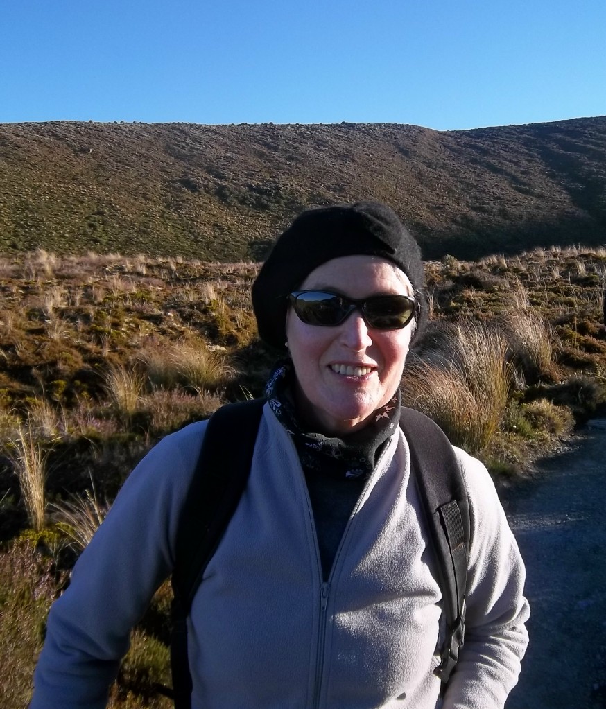
Spot me sat in the middle of the cactus garden

Otari-Wilton Reserve
We caught the bus up to this reserve and did quite a long walk here. It was actually nothing special compared to other reserves we’ve seen, but included a couple of very ancient Rimu trees and a lovely picnic area beside a stream. We ended up walking out of the reserve through pine trees and on up to the skyline walk which was terrific because it gave us great views over Auckland.

Mike on the hills above the Otari-Wilton reserve, with the skyline walkway behind

Zealandia
This really has to be the highlight of our visit: an evening tour beginning half an hour before dusk. Zealandia is a large reserve which includes a dammed lake. All non-native mammals have been eradicated and it’s surrounded by a 6 ft high wire mesh fence to keep invaders out. It contains about 100 kiwis (brown spotted), tuataras, frogs, and loads of lovely rare native birds: takahes, kakas, morepork and a huge shag colony. We’re here to see the kiwis needless to say, and though they don’t guarantee a sighting it’s our best bet and we’re not disappointed. It’s the most beautiful clear cold evening with an enormous full moon. First we come across the huge shag colony just settling down for the night, then 2 takahes come lumbering past us. There are flocks of kakas squabbling loudly above, unsettled by the brightness of the moon perhaps, and but we can only see their silhouettes as they fly overhead. There are tuataras, silent and still on the bank beside the walkway. We've all been supplied with red light torches so the minute anything's spotted our torches are all aimed in the same direction.

The first kiwi we hear because it’s rustling on the bank ahead and we watch it for quite a while as it scrummages for food with its long beak. It’s obviously aware of us but doesn’t seem to mind us so long as we don’t get close. It walks purposely but in a random jerky fashion and eventually disappears into the bush. Our second spot is even closer and the warden thinks it must be Flip flop, a kiwi whose nervous system has been permanently damaged by eating poisoned berries and consequently had a habit of falling over unexpectedly. Tonight he’s digging furiously at the feeding tubes that are buried in the soil. He seems lighter in colour and very fluffy. Their coat is more hair than feather which, along with the long beak, gives them a very endearing appearance. Unlike our first kiwi he’s facing us full on so we get a good look at him before he too wanders away.

Walking back to the entrance we cross the dam and star gaze for a while. The warden is very informative, pointing out the Southern Cross and other constellations. The moonlight is amazingly bright and it’s a beautiful still calm evening. We jump into our waiting taxi are dropped off in Cuba St and have a great meal in the Spanish style Duke Carvell’s.

Crane boat on the waterfront
Wellington Waterfront
On Sunday morning there’s a Liverpool match on the telly so Mike stays in and I wander around the Wellington waterfront which on this bright sunny morning is just fabulous. It’s a little reminiscent of Vancouver, on a smaller scale of course, but with helicopters flying overhead and kayaks and little boats all over the sparkling water. There’s a large open air fruit & veg market just the other side of Te Papa, and an indoor market a little further on, so lots to investigate. There are some good wooden sculptures on the bridge going over to the Civic Centre, interesting old cranes, and warehouses, but a distinct shortage of cafes. We meet up at Te Papa, do the National Art Collection, and grab some street food at the market.

Kayaks and paddle boats on the waterfront

Lots of interesting wood sculpture on the bridge across from the waterfront to the Civic Centre

Red Rocks and beyond
We get a taxi over to Island Bay, because we’re running short of time, and set off walking east mostly in the shadow of the cliffs which tower above us. Wellington is known as the windy city though we found it very calm during our Easter visit; however here, just a little north east of the city, the wind is blowing fiercely. The sea is pretty wild too with huge masses of seaweed swirling around the rocky coastline. We walk around a headland and come across Red Rocks, which, true to its name, is a crop of red rocks (with some blue and green too) amongst the grey, then turning a corner through a gap in the headland it's a whole different world. From deep shade we walk into brilliant sunshine, and looking across to the horizon we clearly see the hilly coastline of South Island across the Cook Straits. Our struggle against the elements had been worthwhile, especially as a little later on our return we see a fur seal lolling about on top of a rock near the water’s edge.

Looking across the Cook Straits to the north coast of South Island

Getting back to the CBD is a bit of a challenge as it’s about 5pm on Easter Sunday, and on the advice of a local we end up road walking over the headland to pick up a bus. Turns out well and we only have to wait 5 minutes before one trundles by.

Halfway up Mt Victoria looking across to Wellington CBD
Looking down from the top of Mt Victoria
Mount Victoria
On our last morning we walk along the waterfront, around the marina, then up to the top of Mt Victoria which has great views over the city. Wellington has some great Art Deco architecture dispersed amongst the weatherboard houses and the modern blocks. Art Deco with its Ocean liner style seems to work very well here in this city with a great waterfront. Having walked back down to the CBD we end up using the loos in the Embassy theatre, Courtenay Place, which seems to have maintained most of its original interior (Classical Style 1924) with curved marble staircase, and fabulous tiles everywhere (even in the toilets!). Cuba St again for lunch then back to the hotel to collect our bags and home to Auckland.

Tuesday, 10 April 2012

Two Boating Weekends

25 March
It’s a warm sunny day and we probably won’t have too many more of them, so today we decide to go kayaking. We make enquiries online and book ourselves into a river trip which follows the Puhoi River from Puhoi, the Bohemian Village, down to the coast at Wenderholm Regional Park. It should be fairly easy going because it’s a tidal river: you set off at high tide and the river takes you down. We were given basic instruction on how to paddle, life jackets were donned, money exchanged hands, and off we went.

Right from the start it was uncomfortable, and knowing we were encased in the kayaks, completely immobile from the waist down, was a bit worrying. If you wriggled to give your spine a stretch you were in danger of capsizing so it wasn’t a good idea. Should have been idyllic really: slowly drifting down river with nothing but a few ducks for company, the occasional kingfisher flashing past, and cows lumbering on the banks; but unfortunately the physical discomfort took the edge off it . . . and it was even tougher for Mike with his 6’ 2” frame.

Yes, this is me doing my stuff on the Puhoi

However we were learning to steer and managed not to get entangled in over-hanging branches or hit the banks or each other. So we reckon we did OK, but were very glad to get out the other end where our hosts gave us and our kayaks a lift back to Puhoi.

We were picked up at the end of the trip and sat like Mum & Dad in the front of the van with all the youngsters in the back

We then enjoyed a good lunch at the famous Puhoi Pub, and drove back down to Wenderholm for a wander round the park. Wenderholm was the first of Auckland’s Regional Parks (there are now at least 26), it’s a lovely piece of land which includes some original bush, a large family homestead, open to the public, with landscaped grounds, and a fabulous beach. It’s situated between two rivers: the Waiwera and the Puhoi which of course we now know quite well.

On the way home we stopped at the Waiwera Hot Thermal Pools. There are about 8 pools of differing temperatures from ridiculously hot to only just warm. The idea was to relax our bodies after the kayaking adventure.

1 April
We’ve had this west coast boat trip booked for ages. It’s a trip up into the Kaipara Harbour, New Zealand’s largest volume of inland water. It’s an enormous natural harbour with loads of streams and rivers running into it and quite a narrow entrance, partly blocked by an underwater sand spit which has caused no end of ship wrecks in the past.

It’s a pretty good day for it and we drive north-west past Helensville at the southern end of the harbour, up to Shelly Beach. We’re driving up a peninsular which is very similar to the Awhitu, on the south-west side of Manukau Harbour. Set sail at 9am and head north, with the captain doing an informal history of the place over the PA. The harbour was a hive of activity from the 1860s up to the 1940s by which time the surrounding area had been pretty much stripped of kauri trees, which were floated down river to the harbour, loaded onto sailing ships, and sent off overseas.

Dropping off at Poutu Point

Watching the flock of terns

More fantastic drift wood on the beach

It’s about a 2 hour boat journey up to Pouto Point on the southern end of North Head. You can clearly see the sand spit covering a large area of the harbour mouth and the currents are strong here so it gets pretty rough. We’re dropped off on the beach and left to our own devices for a couple of hours, during which time we wander up the beach, finding a good spot for lunch, watching a huge flock of terns by the water’s edge. Not quite enough time to get as far as the famous lighthouse but its a terrific beach walk. The boat ride back gets a bit choppy and a few of the little kids are sick, but the sun is still shining brightly.

Monday, 26 March 2012

More of the Tongariro

18 March
We weren’t suffering as much as expected after the doing Tongariro but wanted to loosen up a bit, and as it was another lovely day we went up to Whakapapa (bear in mind that the Maori pronunciation of ‘wh’ is ‘f’) and did a short 2 hour walk from there. Whakapapa is the end of the road where you get a ski lift up to the slopes of Ruapehu, a big skiing resort and another location for the Lord of the Rings movie. It’s also the home of the famous Chateau Tongariro built in 1929, a rather grand hotel, chandeliers and all.

Looking one way towards the misty slopes of Mt Ngauruhoe . . .
. . . and the other way towards Mt Ruapehu

We set off on the Taranaki Falls walk which takes us over land between Mt Tongariro and Mt Ruapehu, heathland with lava flows. There are great views up to both mountains either side. A number of streams and rivers have cut their way through creating quite a varied landscape: a mixture of flat land with tussock grass, heather, manuka and hebes, then valleys with dense woods of mainly beech trees, nice and cool on a hot morning. The hebes are native to New Zealand and grow as large bushes here covered tiny white flowers. Early European settlers called many of the native NZ trees by their European counterparts and NZ black beech trees aren’t really like ours at all.

Crossing a bridge over the river

We follow the path eventually crossing the river and walking beside it till we get to the Taranaki Falls, where the river drops from a great height at the top of cliffs above us, down into a beautiful circular pool surrounded by large boulders. A good lunch spot. There are people right up above us just where the river drops over the edge of the cliff. The walk climbs from here up to the cliff top over the river and across more heathland back to the start.

The Taranaki Falls

We drive from Whakapapa down towards Tourangi where we stop for a soak in the thermal pools at Tokaanu. We start off in a private pool which is really deep and almost too hot, then move into the public pool which is empty so we can swim and soak in not quite such hot water. A lovely relaxing thing to do after a strenuous w/e. We decided it had to be a day of pampering, so went back to Whakapapa to the Chateau for a cream tea.


19 March
We‘re off back to Auckland today and the weather’s on the turn but we just have time for a 2 hour stroll around Lake Rotopounamu in a tiny outpost of the Tongariro National Park, which is on the way back towards Taupo. We walk through ancient forest with lots of large black beech trees and enormous old rimus with really flaky bark. One can’t help being reminded of the walking, talking trees in Lord of the Rings. The lake really lives up to its Maori name which means ‘Greenstone’. In this early grey light it’s the most beautiful deep grey-green colour.

From the shore of Lake Rotopounamu
Looking down on the beautiful symmetry of the tree fern

The path takes us along the beach in a couple of places and we realise it’s all made of pumice stone which floats on the lake. All very strange and we end up with pockets full of pumice stone to bring home. It’s very peaceful here with just a few ducks to keep us company and a few other birds hiding in the trees. The rain begins to fall gently as we get back to the car, but by the time we reach Taupo it’s chucking it down. We stop for lunch then continue the 4 hour drive back to Auckland.

Wednesday, 21 March 2012

The Tongariro Crossing

16-17 March
It’s about a 4.5 hour drive down south to the Tongariro National Park and, though Mike left work early and we were all packed up, we still didn’t get there till after dark. So we dined on beer and sandwiches and didn’t bother going out to find a restaurant. We’re staying at the Tongariro Crossing Lodge in the ski/hikers village which calls itself National Park, a pretty soulless grid structure town. We’re booked in for transport for tomorrow which looks to be a fine day, fingers crossed.


The Tongariro Crossing is billed as one of the top ten day walks in the world. It’s a 19.4 kms hike across the active volcanic field which is Tongariro National Park. The distance isn’t too bad but it’s quite a climb up, nearly 1000m, and you drop down even more, it being a linear walk with the collection point 400m lower than the drop off point. It’s also notorious for dramatically changing weather conditions and you’re warned to take all weather gear with you accordingly, as well as food and plenty of water, which means heavy packs. Anything up to 1000 people do it daily, so at least you know you’ve got company. We’ve been planning on doing this for months and now we’re here I’m feeling a little apprehensive about it, worried about little aches and pains etc, and consequently don’t sleep that well. Set the alarm to wake up at 5.45, breakfast, take paracetamol as a precautinary measure, and we're ready for the bus to collects us from the lodge at 7am. The bus stops at backpackers places and collects lots more people, most less than half our age. We arrive at the end of the road car park at Mangatepopo and set off at 7.50am.

Right at the start with shiny boots and the sun just coming up. It was freezing at the start and we needed hats, gloves, scarves: the works. Of course the minute you found yourself walking in sunshine all this lot had to come off again. At times we couldn't see where we were going because the sun was so bright and so low on the horizon. I ended up borrowing Mike's old peaked cap which helped a lot.
In my IRA gear preparing for the assault on the Tongariro
Approaching the Devil's Staircase on relatively flat boggy land.Some of the route was on raised boards to preserve the surrounding plantlife and get you over the swampy bits. I guess with anything up to 1000 doing the walk every day it becomes a necessary measure.

The rocky land around us is made up of ash fields and lava flows. Lichen seems to be one of the earliest plants to take hold up here. The mountains around us have erupted fairly recently, Mt Ngauruhoe in 2007, and Mt Tongariro in 1997, and the lava flows are still very much in evidence.
Beginning the ascent, looking back towards our starting point with the Devil's Staircase ahead of us. As the bus driver told us, a lot of the Devil was taken out of it when new steps were added making it a bit easier underfoot. The people walking away from the camera have probably done the 3-day round trip of the mountains and are returning to Mangetapopo
The first saddle. The signpost indicates the unmarked path up Mt Ngauruhoe which addes another 3 hours on to the trip, not to mention the extra metres of climbing. We continued from here on down into the South Crater
Mike in the middle of the south crater with Mt Ngauruhoe behind. You can just see the edge of a lava flow in between Mike and the volcano. This is a near-perfect volcanic cone which was apparently Peter Jackson's inspiration for Mt Doom in the Lord of the Rings movie, a lot of which was filmed around here

Crossing the South Crater with the second saddle straight ahead. Just a few bits of tussock grass here and little else but rock and dust. The path takes us straight across the crater, over the saddle, and on up to the Red Crater
On the second saddle looking up towards the ridge which takes you to the summit of Mt Tongariro (1967m), a 2 hour extension to the walk. Buses at the other end leave at 3.30 and 5.00 pm and it's still quite early in the day, so we have the time, but do we have the stamina? We could more or less see the ascent from here and it looks like there isn't too much downhill, so we decide to go for it. 
Looking through a gap in the rock on the ridge going up to Mt Tongariro
On the pathway up to the summit, looking back towards Mt Ngauruhoe. There were masses of weird rock formations on the ridge

Nearing the summit with Ngauruhoe behind me. Don't know where my sunglasses are
On the way back down again and we can see the route people are taking along the Tongariro Crossing as they're silhoueted along its highest point. The path is pretty rough: crushed rock, ash and pumice, not a hard surface at all, so at every step your feet are slipping and moving around.
Having got back down to the saddle we continue back onto the Crossing route and, reaching the highest point, look down into the Red Crater. Very high temperatures, oxidise the iron in the rock to create this deep red colour. It's impossible to get a handle on the scale of it here but you can see the huge fissure which would have belched molten rock not too many years ago. From here on in the smell of sulphur is quite strong and you can see steam issuing forth from fumeroles along the banks here and there.
Slipping and sliding down towards the 3 Emerald lakes. You can see some fumeroles just to the right of the lakes and to the left you can see the Crossing route across the Central Crater. Getting down this crumbling slope without falling over was probably the hardest part of the walk. The little lakes below are gem-like in colour and so enticing, especially as we were on the lookout for a lunch spot by now.
This was the smallest of the three, with lots of people camped around it resting and eating lunch
We parked ourselves by this lake for lunch, the largest of the three. The strangest thing is that the water is warm, but if you wash your hands and remove them, they are immediately freezing cold because of the air temperature. It is a magical place.
This is taken from the far side of the lake.  The ground was warm underfoot here which makes it a little scary in case you go through the thin crust of earth
Walking around the edge. There was a lot of sulphur smell around this side with steam issuing forth unexpectedly from holes between the rocks, so you have to step carefully
Taken on the far side of the lake. Behind our heads you can just see a few people descending from the highest point
Looking back at the mountains from the ridge at the far side of the Central Crater with the cone of Mt Ngauruhoe in the centre behind the Red Crater. You can make out the path of the Crossing from its highest point down across the Central Crater. The lakes are all hidden by the rise and fall of the land. It was pretty much downhill all the way from this point. The dark mass central right is the extent of lava flow
Mike ahead on the descent, with Lake Rotoaira immediately behind him and Lake Taupo in the far far distance. We are very lucky to get such an amazingly clear day. From here on the path is pretty good but it's tough going because we're tired by this stage. It probably takes another 3 hours from this point to get down to the Ketetahi car park where our bus picks us up.
This side of the mountains is more alpine in terms of plant life with loads of mosses and lichens and tiny bell flowers
Eventually, after descending a never-ending zig-zag path, we entered an area of woodland and followed a stream back down to the car park. Back at the lodge we showered, went out for a celebratory meal, then back for a good nights sleep. It really was the most amazing day's walking and we both agreed the Tongariro Crossing definitely lives up to its reputation as one of the best one-day walks in the world, though not sure we'd have felt quite the same if we hadn't been blessed with such a perfect day for it.

Wednesday, 14 March 2012

Manukau Harbour

Auckland CBD is built between 2 enormous natural harbours: Waitemata to the north and east , Manukau to the south and west. We completed the coast to coast walk fairly recently between the two which is only about 18kms. Over the last couple of weeks we’ve discovered more about the area around Manukau Harbour visiting 2 of the Auckland Regional Parks adjacent to it. The harbour itself is really shallow and roughly 20 kilometres square in area. A while back we visited Whatipu and climbed up to the top of North head overlooking the fairly narrow mouth of the harbour.

Island on Brooks Bay

Awhitu, 4 March
This is a long peninsular extending northwards at the far westerly side of Manukau Harbour. From the map we imagined the area to be pretty flat but in fact it was extremely hilly, with very pretty green farmland. The road ran along a central ridge for a large section and it was possible to see across to the the Pacific coast on one side and Manukau Harbour to the other. The Awhitu Regional Park is on the harbour side and includes some farmland settled back in the 1860s by the Brook family. There’s also some wetland and a couple of white sand beaches. We walked around a large pond spotting kingfishers and scaring the pukekoes, then had lunch on a piece of high ground looking across the width of the harbour spotting Auckland’s volcanoes, the Waitakeres and the Hunua Range in the far distance. It was a clear day and you could just spot the Sky Tower. There’s a tiny island in the middle of the Brook’s Bay which we walked out to. It’s a perfect island in miniature with a Nikau palm tree, a pohutukawa, and a Norfolk pine, three trees which are very emblematic of Auckland. We drove further round to the top of the peninsular to see Orua and Wattle Beaches, both much closer to the mouth of the harbour; Orua white sand, Wattle black, reflecting the black sand beaches on the west coast which we were much closer to now, nearing the head of the harbour.

The biggest tree on the Brook's homestead

Ambury 11 March
Has to be a shorter Sunday outing than usual as Mike’s playing in his 7-a-side football tournament this afternoon. Bit of a drizzly day but we set off to Ambury Park which is by Mangere Bridge on the eastern side of Manukau, on the way to the airport. The park is pukeko heaven though I’ve not been quite so keen on them since reading in the local news the other day that they’d attacked a man and left him bleeding. The park has an area devoted to farm animals for kids to pet but it is mainly a working farm, with the foreshore is open to walkers and bird watchers. Mangere Domain is nearby with its sides clearly terraced for the cultivation of kumara by the early Maori settlers. All of Auckland’s volcanoes are important Pa sites for the Maoris as they are easily defendable, and kumara pits and terraces are visible on most of them: the kumara (sweet potato) being their staple diet. Mangere is a relatively recent volcano. It erupted 16,000 years ago and covered this area with a thick layer of black scoria, so it’s rather similar in places to the surface of Rangitoto, with the black volcanic rock contrasting dramatically with the white sea shore which is made up primarily of sea shells. We see stilts and masses of oyster catchers, but not the migrating birds we expected to see.  

The champions, Cunningham Lindsay 7-a-side team. Note the minimum 3 girls: part of the NZ sub-football rules

Mike returns triumphantly bearing a medal as his team won the league trophy. This spells the end of Monday night football so he’s taking up tennis instead. Isn’t this the wrong way round? I mean with Summer officially over here now, shouldn’t the football season be about to start not finishing? Rather typical of New Zealand, where everything is different, upside down, back-to-front, and opposite to what you expect. The water going down the plug hole the wrong way round is really only the beginning.

Thursday, 8 March 2012

Tiritiri Matangi

Friday 24 February
We catch the train from Grafton down to Britomart carrying all our gear for the w/e. Tiritiri Matangi is an open reserve, a bird sanctuary, an island, and one of the few places where there’s a chance of spotting a kiwi in the wild. The trip is run by 360 Discovery and there are lots of DOC volunteers on the boat to give us info and advice. This is Mike’s birthday treat and has been booked for ages because we wanted to stay overnight (kiwis being nocturnal) and the DOC hut (Department of Conservation) is booked up a long way in advance. There are no shops or cafes so we’re taking all our food with us for the w/e. The island’s fairly small, you can easily walk around it in a day, and it’s north of Auckland, about 1.5 hours on the ferry.  It was farm land back in 1980, with only a few pockets of native bush but since being taken over by DOC it’s been re-planted and made rodent free so rare birds can thrive.

Hobb's Beach from the Kowerau track


Takahes grazing
We land about 10.30 and our gear is transported up to the hut for us while we’re being sorted into groups for a guided tour. Greg meets us at the wharf. He’s a 19 year old takahe, a poor tatty old thing, that has modified behaviour and consequently seeks out humans rather than avoiding them. We’re under strict instructions not to feed him. There are only about 200 takahes left in the world, they are large flightless birds, similar to the pukeko but much heavier. Back in the 1940s they were thought to be extinct but then a small group was found in the Southern Alps. There are about a dozen on Tiritiri and they continue to breed and increase in number. We are taken along a path to Hobbs Beach, past the penguin boxes, up through one of the oldest sections of bush back around to the Bunkhouse. In the space of a couple of hours we’ve seen the North Island robin, saddlebacks, whiteheads, stitchbirds, fantails, bell birds, kakarikis, and of course tuis. Our guide is really informative, recognising the different bird songs, naming local trees, pointing out kiwi holes on the beach, and giving us lots of history about the island. There are a number of feeding stations providing sugar water primarily for the stitchbirds (hihis) but also attracting loads of bell birds whose beautiful song is all around us.

Mike with lighthouse

Bell Bird


Back at the bunkhouse we get to meet the rest of the bunch here for the night:  2 lovely families, some young researchers, and a few others, sharing 3 dormitories. There are a couple of fridges and a heavy duty gas cooker. After dinner we all set off in groups clutching with our torches. We keep well back from the kids who are noisy enough to scare any wildlife away for sure. At dusk we walk along down towards the wharf where penguins have been spotted, then along Hobbs Beach where we see a lone penguin who seems to be settling down for the night. By now it’s dark and we frequently stop and sit silently listening out for sounds. We can hear kiwis but sadly don’t see any. I guess the kids have scared them all away.

Little Blue Penguin
Walking further up towards the Ridge track we hear rustling and see a large tuatara on the bank beside us. It stops still and we get a good look at it but, in our surprise, completely forget to photograph it. Tuataras are large lizard type creatures. This one’s about 2 foot long. They are another of those strange one-off NZ animals, unrelated to any others, and quite rare, so we’re pleased to have seen one. Just before returning to our beds we sit gazing at the bright stars overhead. The Milky Way arcs right above us and in the far distance we can just see the lights of Auckland twinkling on the horizon. A magical evening.

Above the Arches, Fisherman's Bay, east coast

The birthday boy

Saturday 25 February
We get up about 6 am to catch the dawn chorus then have breakfast altogether round the kitchen table, and go off walking again up the eastern side of the island. Make our way down to Fisherman’s Bay where there’s a family of oyster catchers and some shags. It’s a lovely peaceful little bay with loads of sea shells and drift wood washed up. Then the kids arrive and chase the birds away as they charge over to show us their beach-combing finds. They are great kids but don’t really mix with bird-watching. Back to the bunkhouse for lunch then pack up to go back on the ferry. It’s a windy day and by now the sea’s looking pretty rough and I’m wondering if we’re going to make it back at all. Turns out to be a fun journey with loads of shrieking and laughing as the boat rocks and reels its way back to Auckland.

Oyster Catchers and Shags before the kids arrive

Sunday 26 February
HAPPY BIRTHDAY MICHAEL! A pleasant day with Mike opening little presies in the morning, then coffee and cake over at the Wintergarden Cafe. We manage to skype all the kids too and have a nice meal out in the evening though I can’t for the life of me remember where we went.