16-17 March
It’s about a 4.5 hour drive down south to the Tongariro National Park and, though Mike left work early and we were all packed up, we still didn’t get there till after dark. So we dined on beer and sandwiches and didn’t bother going out to find a restaurant. We’re staying at the Tongariro Crossing Lodge in the ski/hikers village which calls itself National Park, a pretty soulless grid structure town. We’re booked in for transport for tomorrow which looks to be a fine day, fingers crossed.
The Tongariro Crossing is billed as one of the top ten day walks in the world. It’s a 19.4 kms hike across the active volcanic field which is Tongariro National Park. The distance isn’t too bad but it’s quite a climb up, nearly 1000m, and you drop down even more, it being a linear walk with the collection point 400m lower than the drop off point. It’s also notorious for dramatically changing weather conditions and you’re warned to take all weather gear with you accordingly, as well as food and plenty of water, which means heavy packs. Anything up to 1000 people do it daily, so at least you know you’ve got company. We’ve been planning on doing this for months and now we’re here I’m feeling a little apprehensive about it, worried about little aches and pains etc, and consequently don’t sleep that well. Set the alarm to wake up at 5.45, breakfast, take paracetamol as a precautinary measure, and we're ready for the bus to collects us from the lodge at 7am. The bus stops at backpackers places and collects lots more people, most less than half our age. We arrive at the end of the road car park at Mangatepopo and set off at 7.50am.
 |
| Right at the start with shiny boots and the sun just coming up. It was freezing at the start and we needed hats, gloves, scarves: the works. Of course the minute you found yourself walking in sunshine all this lot had to come off again. At times we couldn't see where we were going because the sun was so bright and so low on the horizon. I ended up borrowing Mike's old peaked cap which helped a lot. |
 |
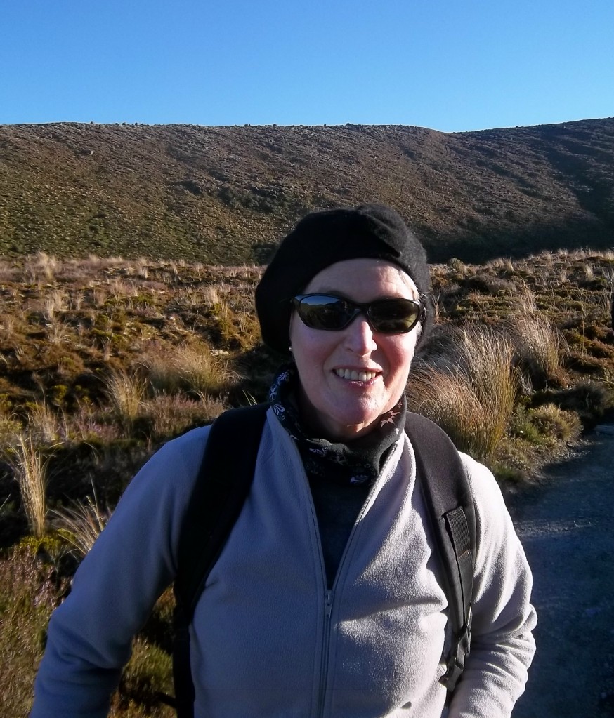
In my IRA gear preparing for the assault on the Tongariro
|
 |
| Approaching the Devil's Staircase on relatively flat boggy land.Some of the route was on raised boards to preserve the surrounding plantlife and get you over the swampy bits. I guess with anything up to 1000 doing the walk every day it becomes a necessary measure. |
 |
| The rocky land around us is made up of ash fields and lava flows. Lichen seems to be one of the earliest plants to take hold up here. The mountains around us have erupted fairly recently, Mt Ngauruhoe in 2007, and Mt Tongariro in 1997, and the lava flows are still very much in evidence. |
 |
| Beginning the ascent, looking back towards our starting point with the Devil's Staircase ahead of us. As the bus driver told us, a lot of the Devil was taken out of it when new steps were added making it a bit easier underfoot. The people walking away from the camera have probably done the 3-day round trip of the mountains and are returning to Mangetapopo |
 |
| The first saddle. The signpost indicates the unmarked path up Mt Ngauruhoe which addes another 3 hours on to the trip, not to mention the extra metres of climbing. We continued from here on down into the South Crater |
 |
| Mike in the middle of the south crater with Mt Ngauruhoe behind. You can just see the edge of a lava flow in between Mike and the volcano. This is a near-perfect volcanic cone which was apparently Peter Jackson's inspiration for Mt Doom in the Lord of the Rings movie, a lot of which was filmed around here |
 |
| Crossing the South Crater with the second saddle straight ahead. Just a few bits of tussock grass here and little else but rock and dust. The path takes us straight across the crater, over the saddle, and on up to the Red Crater |
 |
| On the second saddle looking up towards the ridge which takes you to the summit of Mt Tongariro (1967m), a 2 hour extension to the walk. Buses at the other end leave at 3.30 and 5.00 pm and it's still quite early in the day, so we have the time, but do we have the stamina? We could more or less see the ascent from here and it looks like there isn't too much downhill, so we decide to go for it. |
 |
| Looking through a gap in the rock on the ridge going up to Mt Tongariro |
 |
| On the pathway up to the summit, looking back towards Mt Ngauruhoe. There were masses of weird rock formations on the ridge |
 |
| Nearing the summit with Ngauruhoe behind me. Don't know where my sunglasses are |
 |
| On the way back down again and we can see the route people are taking along the Tongariro Crossing as they're silhoueted along its highest point. The path is pretty rough: crushed rock, ash and pumice, not a hard surface at all, so at every step your feet are slipping and moving around. |
|
 |
| Having got back down to the saddle we continue back onto the Crossing route and, reaching the highest point, look down into the Red Crater. Very high temperatures, oxidise the iron in the rock to create this deep red colour. It's impossible to get a handle on the scale of it here but you can see the huge fissure which would have belched molten rock not too many years ago. From here on in the smell of sulphur is quite strong and you can see steam issuing forth from fumeroles along the banks here and there. |
 |
| Slipping and sliding down towards the 3 Emerald lakes. You can see some fumeroles just to the right of the lakes and to the left you can see the Crossing route across the Central Crater. Getting down this crumbling slope without falling over was probably the hardest part of the walk. The little lakes below are gem-like in colour and so enticing, especially as we were on the lookout for a lunch spot by now. |
 |
| This was the smallest of the three, with lots of people camped around it resting and eating lunch |
 |
| We parked ourselves by this lake for lunch, the largest of the three. The strangest thing is that the water is warm, but if you wash your hands and remove them, they are immediately freezing cold because of the air temperature. It is a magical place. |
 |
| This is taken from the far side of the lake. The ground was warm underfoot here which makes it a little scary in case you go through the thin crust of earth |
 |
| Walking around the edge. There was a lot of sulphur smell around this side with steam issuing forth unexpectedly from holes between the rocks, so you have to step carefully |
 |
| Taken on the far side of the lake. Behind our heads you can just see a few people descending from the highest point |
 |
| Looking back at the mountains from the ridge at the far side of the Central Crater with the cone of Mt Ngauruhoe in the centre behind the Red Crater. You can make out the path of the Crossing from its highest point down across the Central Crater. The lakes are all hidden by the rise and fall of the land. It was pretty much downhill all the way from this point. The dark mass central right is the extent of lava flow |
 |
| Mike ahead on the descent, with Lake Rotoaira immediately behind him and Lake Taupo in the far far distance. We are very lucky to get such an amazingly clear day. From here on the path is pretty good but it's tough going because we're tired by this stage. It probably takes another 3 hours from this point to get down to the Ketetahi car park where our bus picks us up. |
 |
| This side of the mountains is more alpine in terms of plant life with loads of mosses and lichens and tiny bell flowers |
Eventually, after descending a never-ending zig-zag path, we entered an area of woodland and followed a stream back down to the car park. Back at the lodge we showered, went out for a celebratory meal, then back for a good nights sleep. It really was the most amazing day's walking and we both agreed the Tongariro Crossing definitely lives up to its reputation as one of the best one-day walks in the world, though not sure we'd have felt quite the same if we hadn't been blessed with such a perfect day for it.


No comments:
Post a Comment