Monday, 20 May 2013

Oamaru 27-28 April

We set off at about 8 o’clock on Saturday morning, driving first west through Riccarton and Hornby then southwest towards Timaru. We’re driving through the wide flat expanse of the Canterbury Plains so not that exciting, but we’re getting glimpses of the snow-clad Southern Alps to our right as we go.

Timaru turns out to be quite a large town, but, being famous for pioneering the export of frozen lamb, it hadn’t really appealed as a place to stay for the w/e.

Inside the Steampunk HQ, Oamaru
 
The journey to Oamaru takes about 3.5 hours including stops so we arrive before lunch and do a quick trip to the Tourist Info and visit the Victorian Gothic Steampunk HQ which is quite fun. Afterwards we plan to visit the amazing local limestone areas which have been used for various film sets.
 

Derelict film set for Kingdom Come set into the hillside behind Elephant Rocks
 
The first is a rather lovely valley setting used in the Narnia films, which is also a whale bone fossil site. Whale bones clearly on view but it’s very slippery underfoot and a young bull hiding in the corner of the field speeds our departure. A little bit further on we find the well-fenced off film set for the abandoned Kingdom Come movie, and in another 100m the amazing Elephant Rocks.


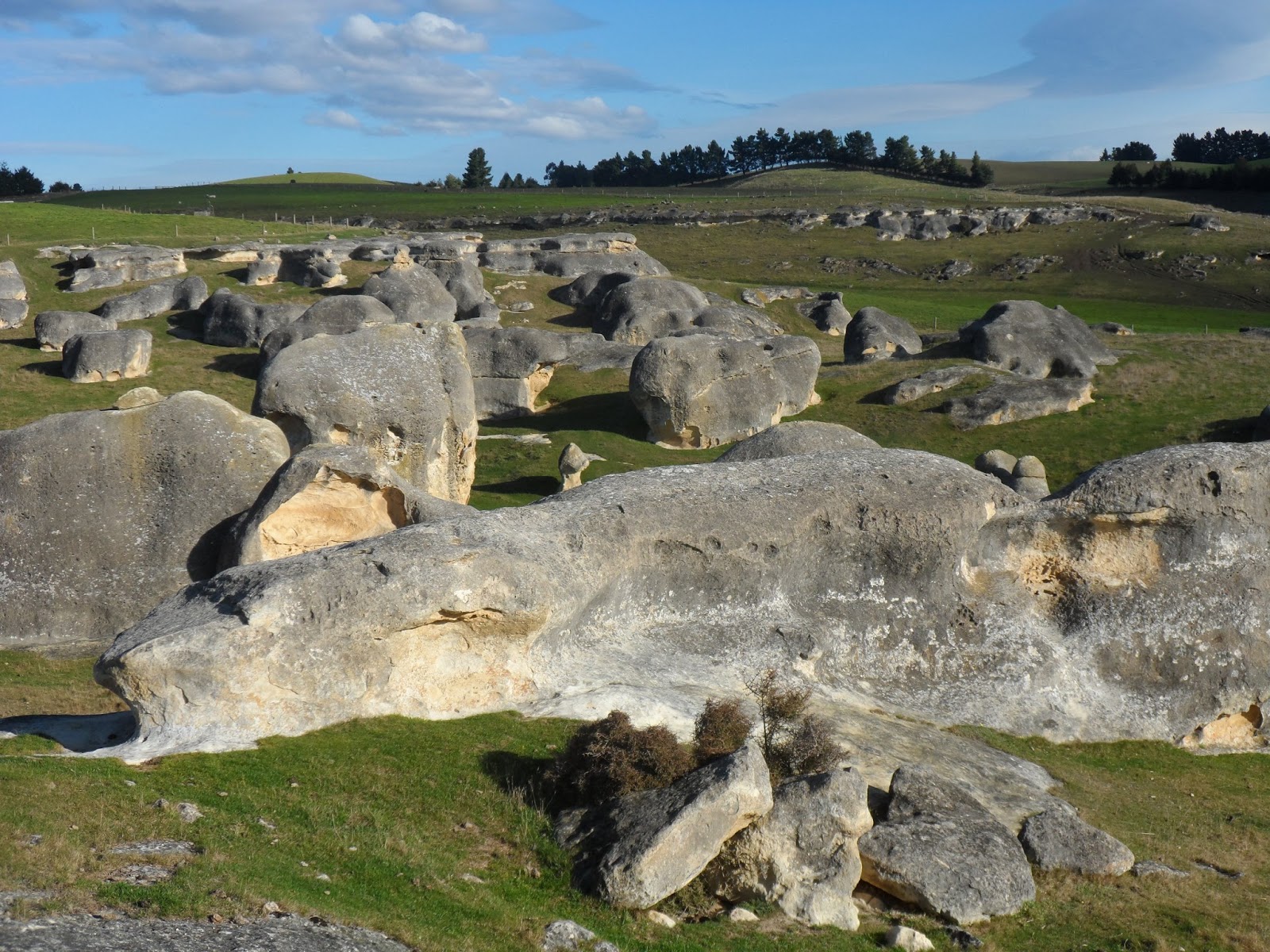
This is the place I really want to see after finding images on the net but seeing it for real was something else. It’s impressive, in the same way that Stonehenge is, but of course these stones are natural not man-made and cover a much larger area. They are huge chunks of Otekaike limestone that have been wind and water eroded over millions of years to produce weird and wonderful shapes. Some are a little elephant-like, maybe because of the grey colour on the exposed rock but we also spot a tortoise, a duck, a frog, and a dinosaur or two.


Initially we’re here on our own and wander around for ages till others join us. Imagine having Stonehenge all to yourself on a beautiful sunny late afternoon. Just amazing!


Eventually we tear ourselves away, drive back to Oamaru, and check into our b&b, Oamaru Creek,  a lovely old wooden 2-story building, furnished and decorated to match. We get a cheery welcome from the owners who recommend we try and catch the endangered yellow eyed penguin colony just around the headland from the harbour, so we rush off just as the sun’s setting.

The colony is small and there are a few people gathered up high on the cliff penguin spotting and sure enough we see 4 or 5 of this quite rare species jumping out of the sea and drying themselves off before settling down for the night at the back of the beach. Just as well we have binoculars though, the beach is a long way down.

We end up going out to eat fairly late and walk through town from the b&b following a footpath around the harbour. Almost there and we spot 3 little blue penguins waddling across the path. After dinner on our return we pass the same spot and hear loud snoring coming from underneath an old wooden shed beside the track. We can see where the penguins have hollowed beneath the shed to make a snug burrow. Didn’t know penguins snore and it sounds quite human.


Sunrise over the Pacific

Next morning I wake up early hoping to catch my first Pacific sunrise. It had been quite chilly going out at night but this morning the wind has changed direction and there’s a warm breeze from the north. We walk back to the harbour and right to the end of the long pier where there are a couple of fishermen and some photographers hoping to catch the sunrise. Back for a hearty breakfast then we wander back to the old stone warehouse street for the Farmer’s Market.
 
Walking back down the pier after the sun has risen with Oamaru harbour on the right

Street of old warehouses where the Farmer's Market is set up

After packing up the car we head for the Moeraki boulders, another of the famous landmarks of the area. They’re a short drive south, scattered in groups or individually on the beach. They are spherical in shape measuring 1-2 m in diameter. Some are still in the process of breaking out from the mudstone cliffs at the back of the beach. Very strange indeed. After a long walk along the beach we set off back to Christchurch.


Monday, 6 May 2013

Day Trips Out


Port Hills, 7 April
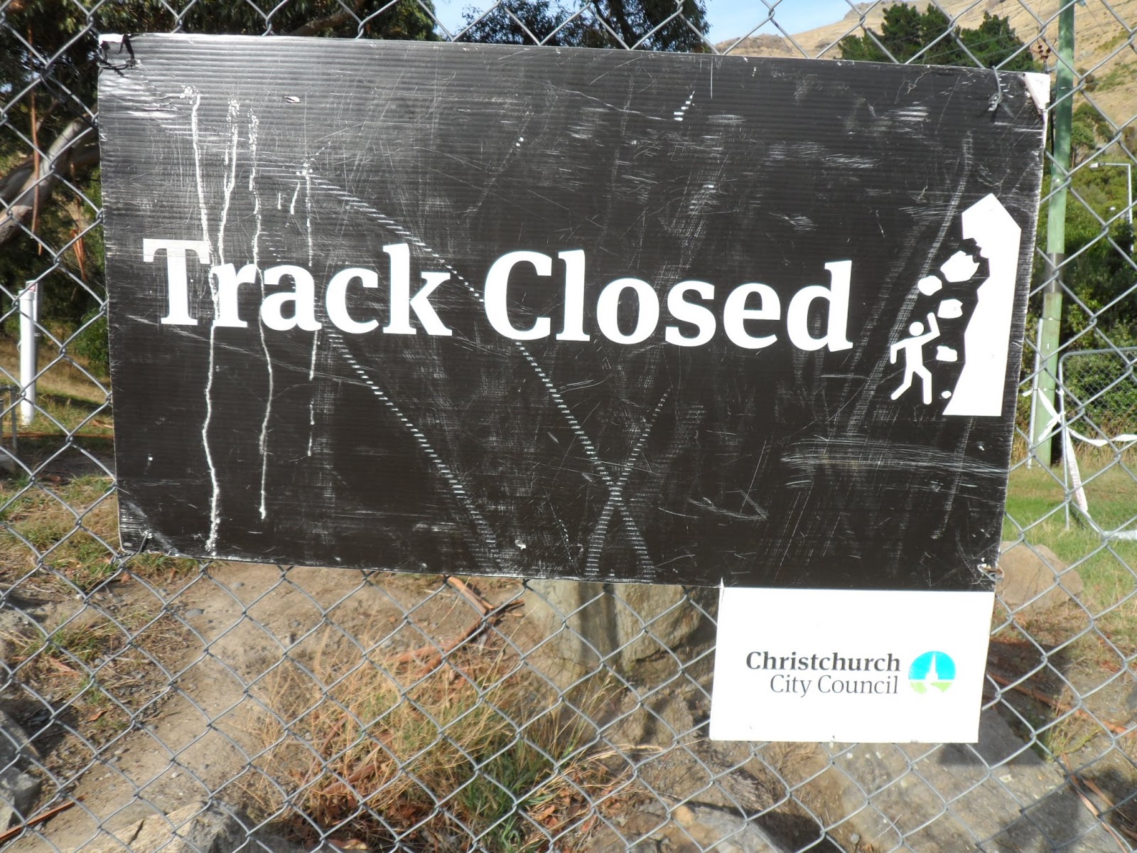
Our first walk and we travel south into the Port Hills which separate the port of Lyttleton from Christchurch. The sign on the fenced off track didn’t bode well but we squeezed through the gap and set off uphill. It soon became clear why the track was closed: massive boulders, fallen from Castle Rock, sat blocking the path in places, some more recent than the quakes and it was clear from the signs that experts were attempting to stabilise the rocky outcrops through controlled explosions. There were other people disobeying the signs so we bravely continued on our way.


The views back to Christchurch were terrific and reaching a saddle at the top we were able to look down onto Lyttleton Harbour and the Banks Peninsular beyond. Lyttleton is an active port with cruise ships and massive container ships. It also exports timber and there’s a tunnel through the Port Hills linking it to Christchurch.
 
Having climbed up to the saddle we could look down on the town and port of Lyttleton and across to Diamond Harbour on the Banks Peninsular beyond
 
We carried on walking along the crest of the hill ridge up to the cafe which stands at the top of the gondola for a well-earned coffee and more great views down to Christchurch.

Peak Hill, 14 April
A beautiful clear bright day and we drive west out of Christchurch towards Lake Coleridge. The Canterbury Plains stretch wide and flat either side of us with their tall pine hedge windbreaks separating the fields, and straight ahead of us the snow-topped mountains of the Southern Alps. We found the starting point of the walk at the side of a gravel road and set off across a field, then up a pretty steep hillside.

On the way up , looking down at Lake Coleridge, with the parallel lines of the tall Canterbury hedges

As we climbed the views improved of course and we could look down over the lake one side and the Rakaia River on the other, with the Alps ahead in the distance. The Rakaia is one of those beautiful, untamed braided rivers cutting a wide path over a stony bed. The path going up was a bit of a slippery scramble on the lower slopes but then became a stony track and then finally a ridge path to the top. There were some strange spiky native plants beside the path, very unforgiving if you accidentally brushed past them.

From the top with the Rakaia River running down from the snow capped Southern alps

It was pretty windy at the top so after a good look around we descended a bit and found a sheltered spot for lunch, before getting back down to the car. Quite a tough 4 hour walk and we needed a quick sleep in the car before driving home again.

Waikuku Beach, Anzac Day, 25 April
Anzac Day falls on a Thursday and everyone has the day off so we go due north to Waikuku Beach, stopping off at the Brick Mill Cafe for an early lunch. The cafe, on the site of an old water mill, has an art gallery, a jewellery workshop, and an antiques and collectables shop beside it, so makes for a good stop.

A young shag on Waikuku Beach

Waikuku Beach is one of those great long stretches of yellow sand bordered by sand dunes and pine forests that stretches on and on as far as the eye can see. My only other experience of local beaches here is New Brighton which didn’t make much of an impression on a cold grey day but Waikuku is fabulous and I know we’ll be swimming here in the Summer, it being only half an hour away from Christchurch. We walk barefoot encountering a couple of rather lost-looking shags, past driftwood tree trunks,and  watching the surfers catching the waves.

Diamond Harbour, 1 May
It’s a Wednesday morning promising to be a beautiful day and as I don’t have much on I decide to be a tourist for the day. I catch a bus round the corner from our house which takes me all the way to the port of Lyttleton, about a 45 minute journey taking me through the tunnel beneath the Port Hills. A gang of school kids also on the bus make it an interesting but noisy journey.
 
Busy port of Lyttleton with Banks Peninsular in the background, and the little ferry on the right
 
After grabbing a coffee and making a quick trip to the tourist info office for a map, I get the little catamaran ferry across the water to Diamond Harbour on the Banks Peninsular. The sun’s bright, the water’s sparkling and I’m really over-dressed for the day but at least I’ve got my sunglasses. Jumping off onto the wharf on the other side I plan to do a coastal walk eastwards but it’s not a clear path and I end up climbing steeply up a gully ending up on a road at the top. Another look at the map and I go back through the little town and try walking the other way, westwards, around the coast.

Walking around on the coastal path looking across to the far side of the bay
This path is good, following the rocky coastline as close to the sea as possible. It goes through a lovely cool area of pine forest then back down along the winding coast path. Way across the bay I can see a beautiful sandy beach, no buildings, no people, no cars, no road leading to it in fact. Definitely a place to go for the day with a picnic next Summer, though it’s a good two hour walk from the wharf I should think.
 
A good spot for lunch
 
After about an hour I come across a lovely old jetty stacked with dinghies so I sit down at the end of it, and make this my lunch spot. Then time to retrace my steps and take the ferry and bus back home.

Monday, 29 April 2013

Impressions of Christchurch

There are signs of earthquake damage all over the city: houses with patches of board nailed onto them, areas fenced off to prevent access, cracks and gaping holes in pavements and roads, brick walls propped up with scaffolding, not to mention spires beside steeples and of course, road works everywhere.

Christchurch feels more like Europe somehow, the trees and flowers are more familiar, less exotic than Auckland. It’s definitely colder down here with a chill southerly breeze coming from the Antarctic, and definitely Autumnal. Our first Autumn in two years. The city is very flat with the Port Hills to the south and the Banks Peninsular to the south east, yet to be explored.
 
Maque Cottage, home for 4 weeks after a week in the motel. Looks cute homestead from the outside, but inside it’s all modern with designer clean lines. Not very  easy to live in but it’s only for 4 weeks
The first of many fallen steeples. All that remains of the church itself is a pile of rubble, slowly being taken over by weeds
185 white chairs. An art installation on the site of another quake-destroyed church, poignantly commemorates the 185 lives that were lost in the 11 Feb 2011 quake

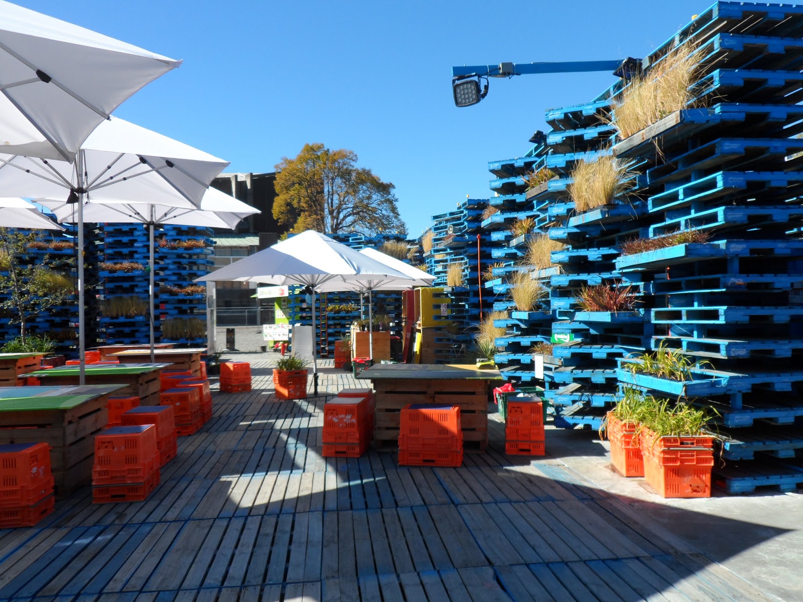
The Pallet Pavilion on Durham St. has been kitted out as a venue and cafe bar. Christchurch youth are very good at this sort of thing, putting life back into the ruined city
This fallen turret is right opposite the entrance to the Botanical Gardens and Museum. I think they’re going to pop it back onto the building eventually. Of course it’s not fallen but removed because it was unsafe
The Cardboard Cathedral is going up pretty fast. A temporary solution till they work out what to do with the ruins of the original. It’s made out of cardboard tubing and being constructed on the site of the CTV building, where many people lost their lives
New Regent St nearing completion. A pleasant shopping street in Spanish Missionary style, it was damaged in the quakes but is now open again for business. The tall building at the end however is being demolished this week
The facade of this red brick neo-classical style building is being held in place by ship containers. The rest of the building didn’t survive but they obviously have plans for the front of it. It's amazing the different uses that have been found in this enterprising city for ship containers

 
The Anglican Cathedral, the fate of which is still being hotly debated. It's right in the hearrtof the city and this is as close as you can get to it
This is what many of our roads look like now in the city centre. Building works, road closures, and traffic cones everywhere
The Thai takeaway container down the bottom of our street. Many enterprising restaurant owners found an alternative way to set up shop after their premises were destroyed
 
St Mary’s church in Merivale, with steeple tied down as if to prevent it from taking off like a rocket
Some parts of the city look normal. Here the Avon River as it flows through the centre of Christchurch on a lovely Autumn day with just a hint of devastation on the building in the background. You can go punting on this river too
Caring graffiti on the side of a ruined church
 

Travelling South to Christchurch

 
27 March
We left Auckland a bit later than anticipated after a fairly stressful pack-up. Stewart and Miranda came to say goodbye and collect the keys, and I was sad to be leaving our lovely Auckland flat. We made good time and stopped at the Huka Falls to stretch our legs a bit. This is the point where the great Waikato River begins its journey from Lake Taupo down to one of our favourite spots, Sunset Beach at Port Waikato. Strange to think we were swimming there only a week ago.


Enormous Lake Taupo. Hard to believe it's the crater of an extinct volcano
 
We rang Anne to let her know we were close by and arrived about 7pm at Julie’s house where they’re staying until their new home is ready. Their belongings had only arrived a day or two ago so we knew we would be able to see the house but not stay there. Great to see them again and very kind of Julie to put us up for two nights in her lovely home on the outskirts of Napier.

Mike with Anne, Andy, and their friend Victoria in front of their new house on top of a hill
 
28 March
So, Napier being the Art Deco capital of New Zealand, we decided to do the official walking tour of the city which took us round the most prominent buildings of that era. It’s an interesting story: Napier was pretty much just a hill town and a port, unable to expand because of surrounding swampland. The earthquake and subsequent fire of 1928 completely destroyed the town but raised the surrounding land considerably enabling the new city to be much enlarged. Architects from Auckland Uni were brought in and builders and craftsmen from all over New Zealand arrived to re-build the city, it being the Depression with little work elsewhere. It was the end of the twenties and early thirties so of course the entire town was designed in the Art Deco style and the Art Deco Trust was founded in the 1960s which helped preserve this heritage.

A&A lent us their bikes and it was great fun to cycle along the sea front north of the city then back down through the sheep fields past the airport and home to Julie’s. We went to meet up with A&A at their new home for a picnic later. The house is high on a hill, south of Napier, surrounded by about 30 acres of land. It’s mostly pine with lots of citrus and olive trees, not to mention a fig tree and a pomegranate bush. Their young friend Victoria also joined us for a lovely picnic outside in the front garden. Julie’s lemon drizzle cake has to get a mention here as the best ever, and I have the recipe now . . .


Napier is rightly proud of its many Art Deco buildings


29 March
Breakfast together then we set off for Martinborough which is just north of Wellington where we’ll catch the ferry. We have plenty of time so make a stop at the Mt Bruce Wildlife Reserve, where we see lots of kakas at feeding time. They don’t seem to take any notice, or have any fear of humans, and happily swoop around your head after food. Martinborough itself is a big wine growing area now and we stay at a pretty little place called the Old Manse. The hosts plied us guests with local wine and nibbles so we were pretty well oiled even before we went out to eat.

What a beauty! The kakas at the Mount Bruce Wildlife Reserve were not remotely interested in people and flew all around, their wing tips brushing our heads

Great statue on the quay in Wellington. He looks as if he's about to surrender himself up to the sea
30 March
We set off early for Wellington and visit the underground Saturday market we’d been to before after a good stroll down by the waterfront. The Interislander ferry departs at 2.30 and dolphins see us off outside Wellington harbour. It’s a good journey across Cook’s Straits especially weaving down through the Marlborough Sounds towards Picton where we dock around 5.30. Our ‘Art Deco’ Apt in Picton is a bit of a disappointment, but we have a pleasant evening eating at a restaurant we  knew from our stay here the Christmas before last.

Entering Marlborough Sounds, the ferry weaves it's way towards Picton through the maze of islands and fjords

31 March
Set off in drizzle, the first rain we’ve seen in ages. Immediately we’re driving up and over high hills to get down into the huge Marlborough wine-growing region. As we travel south the sun comes out and the scenery down the Kaikoura coast is stunning. We stop at a wild beach at Kekerengu with a terrific cafe/restaurant. It’s one of those great beaches covered with driftwood, and brilliant sunshine is sparkling on the surface of the water. The sea’s quite rough and the most fantastic shades of turquoise and blue, a good place to stretch your legs.


Sheltering in my driftwood wigwam at Kekerengu north of Kaikoura
The beach at Kaikoura, wild sea and sky

This road south is squeezed in between the mountains of the Kaikoura range and the sea, and it’s a pretty dramatic. We spot occasional seals on rocks and stop at Kaikoura for a fish and chip lunch. It’s a busy seaside tourist town popular for its whale and dolphin trips, with a seal colony just outside but we only spotted one big seal, well disguised as it sun-bathed on a flat expanse of rock. We wandered on the rock ledges marvelling at the enormous swathes of seaweed rising and falling with the swell of the sea. From here on the road continues for a while in between mountains and sea, and it’s not too long before we arrive in Christchurch and our little motel on Riccarton Road.

Monday, 10 December 2012

Tutukaka Coast


Saturday 20 October
This is our final trip before I return to the UK and we thought we’d explore the Tutukaka coastline, not being able to resist a place with a name like that. We’d touched on it a little on our trip north with Anne and Andy back in July and it looked worth further exploration, so we booked ourselves 2 nights very cheaply in Ngunguru. We set off quite early driving north towards Whangarei, and this time we stop at the Café Eutopia, in Kaiwaka, which we’d passed many times but never stopped at before. A rather lovely, whacky NZ organic fantasy café: good place for a coffee stop.

. . . and it looked even stranger on the inside

Just before reaching Ngunguru we stop for a walk beside the estuary which has a wonderful turquoise river running down past a huge sandspit to the sea. We get to Ngunguru by lunch time and find our bach which turns out to be a small but self-contained space, close but separate from the owner’s house. He’s a lovely little chap, a quarry man (his hands were rough and seriously misshapen) and he has a great little dog called Maisie which Mike becomes very fond of: it has a very loud bark and uses it every time you rattle the front gate. After dumping our stuff we go in search of lunch and end up eating pies in the local café. NZ is famous for its pies but this is my first, smoked fish, and not bad at all.

The sandspit in the distance was impossible to get to without a boat but area surrounding Ngunguru was beautiful

As the day is bright and sunny we decide to shoot off asap on a walk to Whale Bay. The Tutukaka coastline is different from that around our part of NZ in that it has lots of little bays and coves instead of the enormous long pristine beaches we’re used to. We’d picked up a guide to local walks at the i-site in Whangarei and drove to Matapouri, the next village up the coast, which has a fabulous little crescent bay, typical of this area. There are quite a few people around as it’s a holiday w/e, even people in swimming, the water never gets too cold to swim up here.

Matapouri Beach with its turquoise water, much busier than last time we were here (at least a dozen people)

At the far end of the beach we find a track leading off to the left which takes us up onto the headland and along to Whale Bay, another beautiful secluded crescent bay without road access, but quite a few families here enjoying the sunshine. No whales though unfortunately. The walk is circular and we find a route back inland ending up back in Matapouri. Eat out in another local café and back to our little home. 

Looking back to Matapouri from the Whale Bay track

Approaching Whale Bay which was even busier despite there being no road access
 
Sunday 21 October
Weather’s not so good today and we try to walk around the coast from our village. Unfortunately there’s only a small window of opportunity during which you can avoid getting cut off by the rising tide, and in our case we missed it, so had to abort the attempt. Instead we do a coastal walk taking us north up from the village of Tutukaka. It’s a very hilly walk and the winds blowing fiercely. We’re following the many indentations of the coast and walking past some beautiful houses and farms down by the shore.

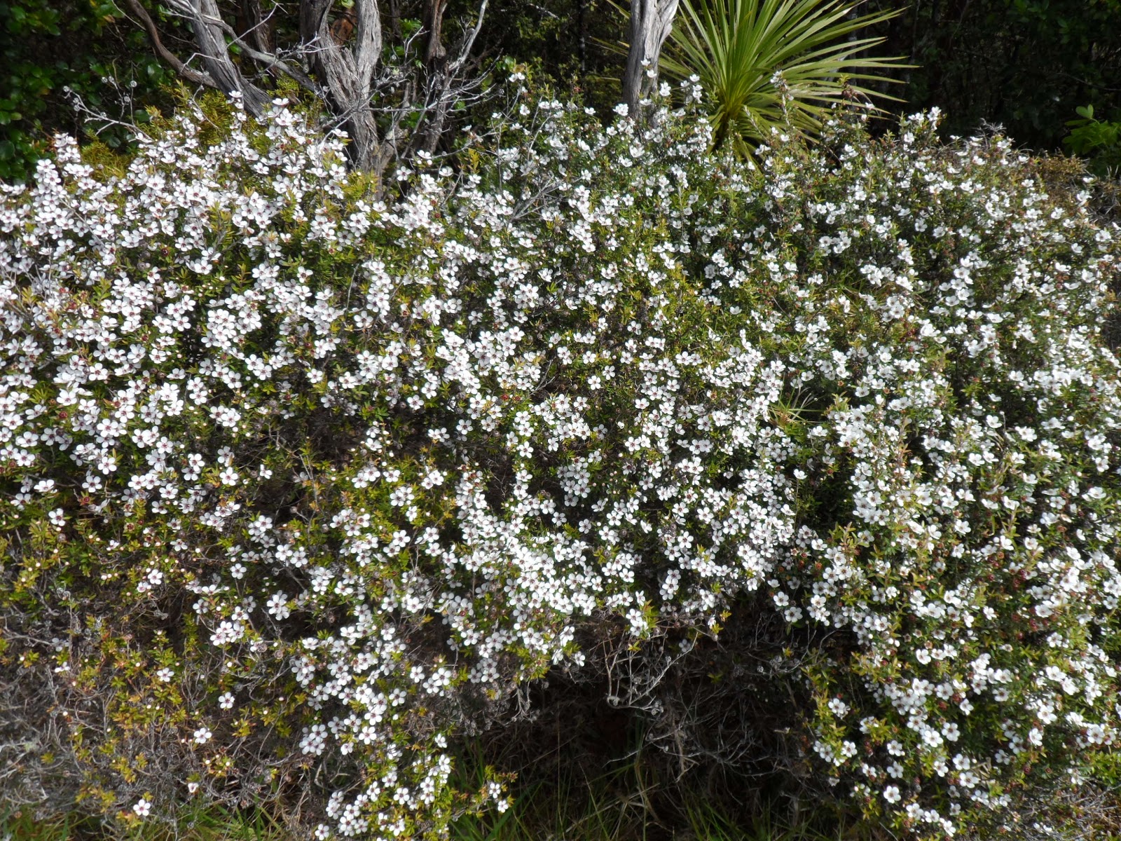
Lovely display of sweet-smelling manuka
An undulating path following the coastline up from the village of Tutukaka

Although the beaches aren’t private here in NZ none of these seem to have public access to them and we can only gaze lovingly down at them from the hills behind the ‘Private Land’ notices being prominently displayed.

Monday 22 October
To the Lighthouse today and the sun’s shining again for us. Set off after Mike’s had his whitebait fritters for breakfast in the local café and park on the headland from which it’s only an hour’s walk.

A short but steep walk from the car park and we're down on the causeway leading to the lighthouse
Looking north along the coast from the lighthouse

We walk along the headland then steeply down to sea level and across the causeway. The lighthouse is only accessible for a couple of hours either side of low tide but we have plenty of time. Over the causeway we climb onto an island which has the lighthouse at its summit, and it’s quite a struggle on a hot day to get up there. There’s a terrific view both ways along the coast from here, showing off the little coves, rocky promontories, and beaches of this beautiful coastline with loads of little boats out enjoying the wonderful weather and calm seas. The lighthouse itself is not much to write home about, not a patch on Jersey’s Corbiere for sure!  

Coming back down again to the causeway. Aperfect day for sailing round the Tutukaka, shame we didn't have a boat

So that’s the end of our little trip up the Tutukaka coast and now it’s just a week till I head back to the UK  for Christmas. So this will be the last of my little travel blogs for quite a while.